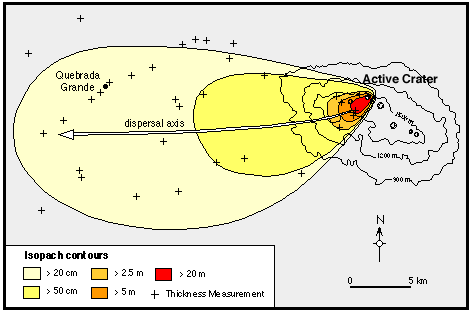
This is an example of an Isopach map for the Rio Blanco tephra deposit. These maps are used to determine the volume of eruption. What can be seen by this map is that when the deposit erupted a strong wind passed by and caused most of the sediment to plant itself west south west of the vent.
No comments:
Post a Comment