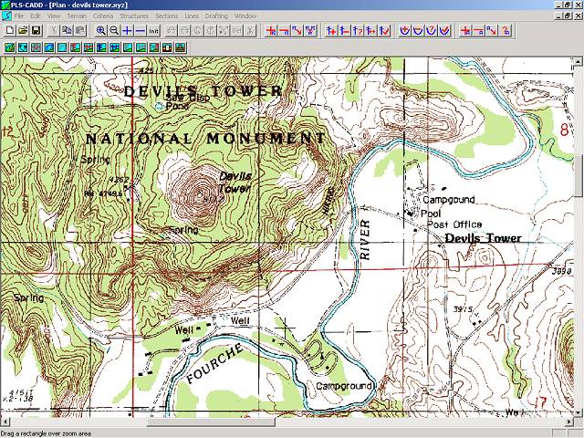
This is an example of a Digital Raster Graphic. The example is of The DEVILS TOWER NATIONAL MONUMENT. A DRG may be used as a source or background layer in a geographic information system (GIS) to collect, review, and revise other digital data. A DRG can be combined with a DEM and a DOQ to produce an image with additional visual information for the extraction and revision of base cartographic information.
No comments:
Post a Comment